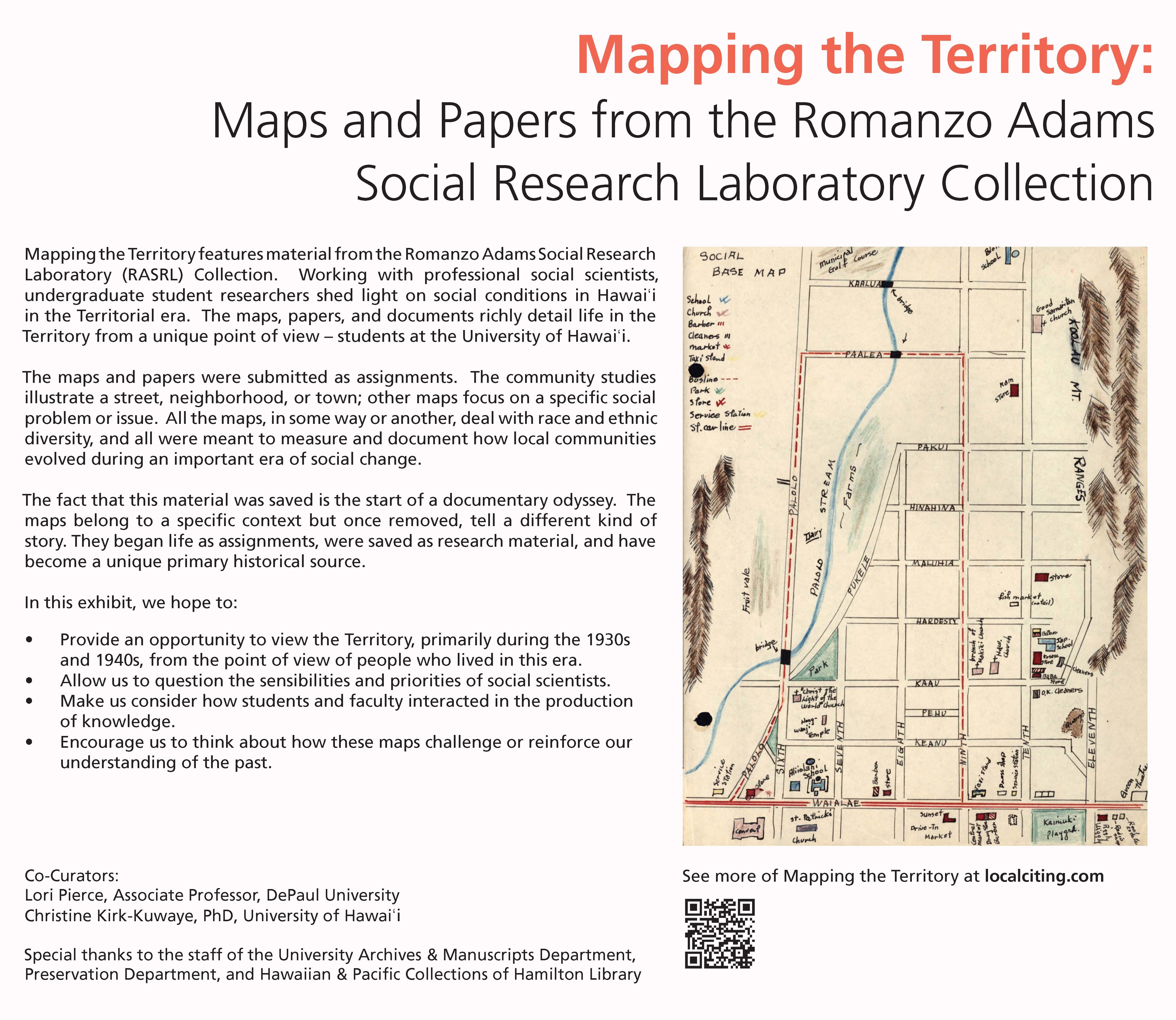
Mapping the Territory features material from the Romanzo Adams Social Research Laboratory (RASRL) Collection. This Collection was named for Romanzo Adams who founded the Department of Sociology and studied race and race relations in the Territory from 1920 to 1942. These maps are community studies and illustrate streets, neighborhood, or towns. Other maps focus on specific social problems or issues. All the maps, in some way or another, deal with race and ethnic diversity, and all were meant to measure and document how local communities evolved during an important era of social change.
The RASRL Collection is part of the University Archives and is housed in the University of Hawai‘i at Mānoa Library. For more information, email archives@hawaii.edu or call 808-956-6047.
Ka Palapala 1932
Mahalo
University of Hawai‘i Library Archives & Manuscripts: Sherman Seki and Asako Shiba
Preservation Department: Deborah Dunn, Christine Takata, Malia Van Heukelem
Hawaiian & Pacific Collections: Dore Minadotani
Also Joy Emoto, Charise Michelsen, Dainan Skeem, Lynn Davis
Additional researchers
Michael Kirk-Kuwaye for his research on and write up of Ōla‘a Village
Background research by Jesse Otto on Kahuku and Reimi Davidson on Pālama
Moir exhibit design
Erica Calegari
Web design
Greg Kuwaye
UHM Campus Center Graphics
Monica Woolsey